sichuan map sichuan tourist map sichuan province chinese and english hand drawn tourist map

Sichuan map Sichuan tourist map Sichuan province Chinese and English hand-drawn tourist map
810.08 Руб.
Scotland Touring Map
Explore new places with this up-to-date map of Scotland. Bestselling map of Scotland. More than 1,000 places of tourist interest plotted and named on the map. The features have been plotted onto an up-to-date and attractive Collins map of Scotland. A clear, easy to follow road map with colour classified roads. Ideal for tourists with hundreds of distinctive tourist symbols and tourist information centres all shown. This map includes: * The whole of Scotland on a double sided sheet at 5 miles to 1 inch * Over 25 categories of tourist information shown on the map including youth hostels, picnic sites and ferries as well as the more obvious tourist sites such as castles, wildlife parks and museums * Detailed town centre maps of Edinburgh, Glasgow, Aberdeen, Dundee, Inverness and Perth * New places of interest including Japanese Garden (near Dollar), Macallan Distillery centre, Moat Brae (Dumfries) and Scottish submarine centre (Helensburgh) * Road updates include the new Dalry bypass, Maybole bypass under construction, A9 dualling sections * New stations of Robroyston and Kintore Scale: 1:316,800 (5 miles to 1 inch). There is a comprehensive index to both place names and places of tourist interest.
1066 Руб.

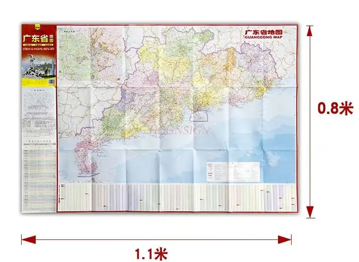
Map of Guangdong Province Chinese and English administrative division transportation tourist map high-definition printing
439.33 Руб.
Collins Ireland Touring Map
Explore new places with handy pocket maps from Collins. Large full colour map of the whole of Ireland showing the road network in detail, and with a special emphasis on places of tourist interest. This map has a handy touring scale of 7.5 miles to 1 inch (1:475,200). It has more than 20 categories of tourist information depicted clearly on the map. There is a full index to place names and places of interest. This map includes: * All classified and most minor roads * Railway network and ferry routes * Viewpoints and sandy beaches * Speed enforcement zones and safety camera locations * Index to 20 categories of tourist information * Includes castles, historic houses, gardens, beaches and golf courses
1209 Руб.
High Atlas Morocco. Trekking Map. 1:100 000
The trekking map of the High Atlas at 1:100 000 includes the region of Jebel Toubkal - the highest peak of Morocco and also the ski station of Oukaimiden. The map also includes a road and tourist map at 1:1 500 000 (1:3 000 000 for Southern Morocco) of the whole country showing tourist attractions. There is also a street plan Marrakech at 1:20 000.
1435 Руб.
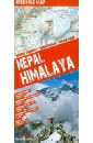
Nepal. Himalaya
This easy-folding laminated map is durable and water resistant. The map includes the region of Everest and Annapurna with detaile topographic and tourist information. The trekking map of the region around Everest is at 1:100 000 scale covering lukla in the south to Gokyo lake in the west, Island Peak in the east and the border with Tibet in the North. The trekking map of the region of Annapurna Dhaulagiri is at 1:150 000 scale. There is also a tourist and road map of Nepal at 1:1 100 000 scale as well as street plans of Kathmandu and Pokara at 1:30 000 scale. The Kathmandu Valley is shown with a 1:100 000 scale map.
911 Руб.
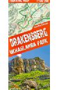
Драконовы горы. ЮАР. Карта 1:100 000 trekking map
This is a unique, handy-in-use trekking map of the Drakensberg in the UKhahlamba Park on the South Africa-Lesotho border. The map stands out for its accurate, detailed topographical and tourism-oriented content. It has been designed especially for enthusiasts of active leisure pursuits who are planning to set off on a trek in the Drakensberg. Produced with the use of the Comfort! Map technology developed by ExpressMap (P), the map is laminated all over, which makes it last longer and ensures that it is exceptionally easy to handle even in the harshest mountain weather. the map covers the whole of the UKhahlamba Park - the highest and the most dramatic area of the Drakensberg rich tourism content (including trekking routes, tourist infrastructure, natural attractions and other sights of tourist interest) shaded relief, representing the area's three-dimensional topography GPS compatibility (WGS84 geographic coordinates) Produced with the use of the Comfort! Map technology developed by ExpressMap (P), the map is laminated all over, which makes it last longer and ensures that it is exceptionally easy to handle even in the harshest mountain weather. Map legend in six languages: English, German, French, Spanish, Italian and Polish.
1544 Руб.
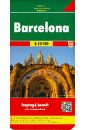
Barcelona 1:10 000
Features the city map of Barcelona, along with tourist information and an index.
750 Руб.
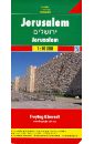
Jerusalem. 1:10 000
Features the map of Jerusalem city, along with tourist information and an index.
1276 Руб.
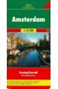
Amsterdam 1:12 500
This road map foldable into a practical format contains detailed information suitable for motorists and other travelers planning to visit the given country or area. The road map features symbols indicating notable tourist attractions and public transportation.
743 Руб.
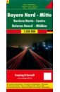
Bavaria North - Middle. 1:200 000
This road map foldable into a practical format contains detailed information suitable for motorists and other travelers planning to visit the given country or area. The road map features symbols indicating notable tourist attractions and public transportation.
743 Руб.
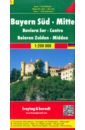
Bayern Sud. Mitte. 1:200 000
This road map foldable into a practical format contains detailed information suitable for motorists and other travelers planning to visit the given country or area. The road map features symbols indicating notable tourist attractions and public transportation.
608 Руб.

Sansibar - Pemba - Mafia. 1:100 000 - 1:150 000
This road map foldable into a practical format contains detailed information suitable for motorists and other travelers planning to visit the given country or area. The road map features symbols indicating notable tourist attractions and public transportation.
1160 Руб.
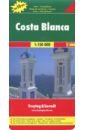
Costa Blanca 1:150 000
This road map foldable into a practical format contains detailed information suitable for motorists and other travelers planning to visit the given country or area. The road map features symbols indicating notable tourist attractions and public transportation.
937 Руб.
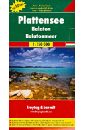
Plattensee. 1:150 000
This road map foldable into a practical format contains detailed information suitable for motorists and other travelers planning to visit the given country or area. The road map features symbols indicating notable tourist attractions and public transportation.
548 Руб.